¶ Summary.
Velkscala is an ongoing sister database project to Eoscala, Confoederatio's main historical geospatial economic statistics project, used primarily for base inferred population data. Current versions of Velkscala utilise HYDE3.2/HYDE3.3 and McEvedy and Jones as a base population layer for complex interpolation, although the release version of Velkscala (Velkscala 1.0) is slated to be upgraded with historical urban population data from Stadestér as well as known settlement pattern functions by region and date.
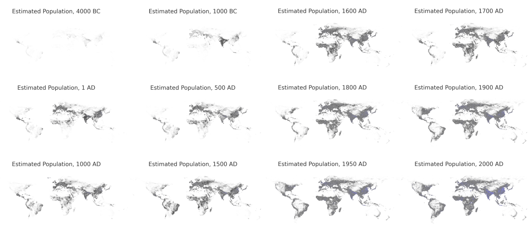
As of Velkscala 0.7, data is mainly self-consistent for the years 10000BC-2023AD, though there may be issues with certain regions. See Velkscala Errors for more information. Rasters are provided at 5-arcminute resolution (WGS84 Equirectangular; 4320x2160), with 1000-year intervals between 10000BC-1AD, 100-year intervals from 1AD-1700AD, 10-year intervals from 1700AD-1950AD, and 1-year intervals from 1950AD-2023AD.
¶ Encoding/Decoding.
Like with Eoscala, data in Velkscala is encoded as 32-bit RGBA int rasters, with the decode function being ((r << 24) | (g << 16) | (b << 8) | a) >>> 0 and the encode function being the inverse function: r = (number >> 24) & 0xFF, g = (number >> 16) & 0xFF, b = (number >> 8) & 0xFF, number & 0xFF. There also exist _number.png and _percentage.png files respectively, where the g channel contains percentile values in 0,5%-step resolution. 0AD is used in place of 1AD. Non-demographic land use data is sourced from a merger between HYDE3.2/3.3 data.
¶ Stocks.
Stock files can be found by looking at the raster file prefix. They are sorted into both Land Use (LU) and Demographic categories.
Demographic.
conv_rangeland: Converted Rangeland (km^2/cell)cropland: Cropland (km^2/cell)grazing: Grazing Land (km^2/cell)ir_norice: Irrigated Non-Rice Cropland (km^2/cell)ir_rice: Irrigated Rice Cropland (km^2/cell)pasture: Pasture Area (km^2/cell)rangeland: Rangeland Area (km^2/cell)rf_norice: Rainfed Non-Rice Cropland (km^2/cell)rf_rice: Rice Cropland (km^2/cell)shifting: Manual Weight Changes (HYDE3.3)tot_irri: Irrigated Area (km^2/cell)tot_rainfed: Rainfed Non-Rice Cropland (km^2/cell)tot_rice: Rice Cropland (km^2/cell)
Land Use (LU).
popc_: Total Population (pop/cell)popd_: Population Density (pop/km^2)rurc_: Rural Population (pop/cell)uopp_: Built-Up Area (km^2/cell)urbc_: Urban Population (pop/cell)
¶ Links.
- Velkscala (GitHub):